Bend Neighborhood Guide · Updated October 23, 2026
Best Neighborhoods in Bend, Oregon: Complete Local Guide
All 13 of the City of Bend’s official Neighborhood Districts plus NorthWest Crossing, Discovery West, Downtown, the Old Mill, Midtown, Tetherow and the communities just outside town, with September 2026 home values, schools, parks, bus routes, drive times and where to stay.
Choosing a neighborhood in Bend is less about one “best” area and more about which version of Bend you want: walk-to-dinner downtown, trails at the door on the westside, a newer house and a yard on the east and south sides, or acreage outside town. This guide covers both the City’s official district map and the names locals and listings actually use, so a listing that says “Westside” or “Midtown” makes sense.
Find your Bend neighborhood
Pick what matters and the list narrows. Tap a result to jump to its full profile.
The City of Bend’s 13 official Neighborhood District boundaries, shaded by typical home value, with pins for the local areas and nearby communities. Tap a district for its numbers.
Every area in one table. Tap a column heading to sort. Typical value is Zillow’s September 2026 index for the district (local areas show their district’s figure). Drive times are no-traffic estimates.
The City of Bend divides the whole city into 13 Neighborhood Districts of different sizes, set up under Bend Code Section 1.70. Districts are independent volunteer groups the City funds and partners with: they get land-use notices, connect neighbors with decision-makers and run community events. They are not HOAs, and one district can contain dozens of subdivisions and locally named neighborhoods.
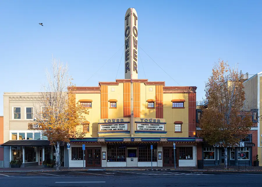
Both. On the City’s current district map, Wall and Bond streets around Oregon and Minnesota avenues (the Tower Theatre, the Oxford Hotel) fall in River West, while the blocks around Franklin and Arizona avenues and all of Drake Park are in Old Bend. NorthWest Crossing and Discovery West are inside Summit West, the Old Mill is inside Southern Crossing, and Midtown is inside the Orchard District.
Neighborhood District vs. HOA (City of Bend)
Neighborhood District
Homeowners association
Funded by
City of Bend tax dollars
Homeowner dues
Represents
Homeowners, renters, businesses and organizations
Homeowners
Size
One of 13 districts covering the city
A subdivision or smaller area inside a district
In City code
Yes, Bend Code 1.70
No
Main job
Land-use input, connecting neighbors with decision-makers, community building
River West has more restaurants, cafes and bars mapped inside it than any other district, and it holds the north half of downtown. Old Bend covers the rest of downtown and Drake Park. NorthWest Crossing’s town center and the Old Mill are the other true walk-to-dinner spots. Walkability in Bend is block-specific: map the exact address against your real errands.
Summit West borders Shevlin Park, a 981-acre BPRD park with a 6-mile loop along Tumalo Creek. Century West sits on the Phil’s Trail side of town and the upper Deschutes River Trail. River West has the river trail and whitewater park. On the east side, the 3.9-mile Larkspur Trail runs from Larkspur Park to Neff Road with a spur up Pilot Butte.
Best for getting toward Mt. Bachelor and the Cascades
With no traffic, it is about 38 minutes from Century West or Tetherow to Mt. Bachelor’s West Village, 39 from Southern Crossing and 40 from Old Bend, versus 47-51 minutes from the east and north districts. Powder mornings and summer weekends add time on Century Drive.
Discovery West on the westside and Southeast Bend around Caldera High have the most new construction. Newer subdivisions also fill the north and east edges of Boyd Acres and parts of Old Farm. Infill townhomes appear in every older district too.
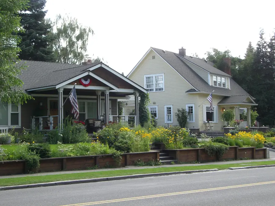
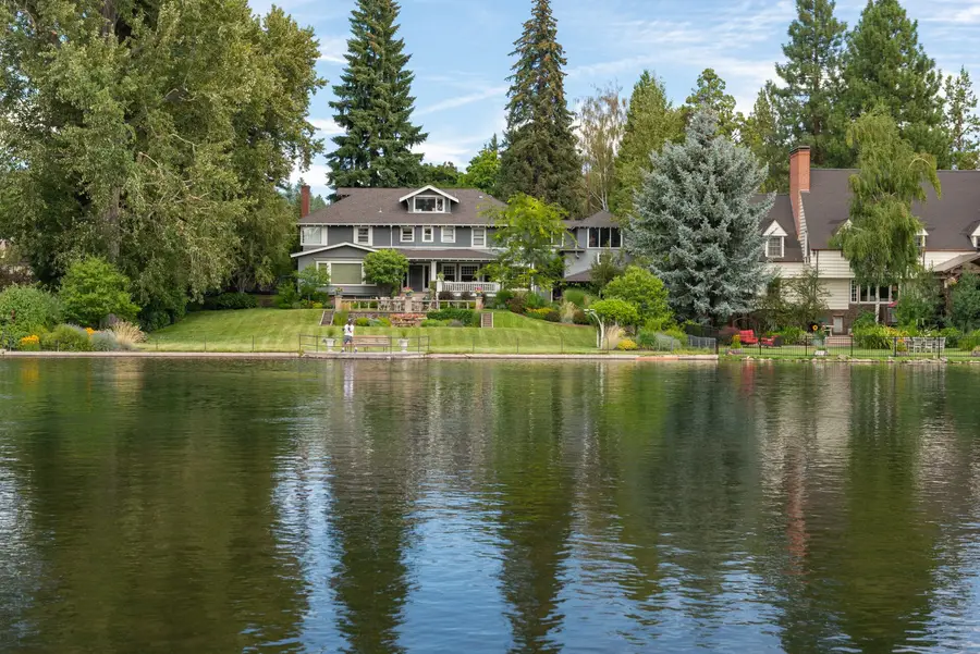
Old Bend and the river blocks of River West hold most of the early-1900s houses around Drake Park and Mirror Pond. Parts of the Orchard District and Midtown have older, smaller houses with more eclectic streets.
Awbrey Butte is the obvious one, and it carries Bend’s highest typical home value. Golf communities on the southwest edge also have Cascade views. The trade-off is topography and wildfire prep: steep driveways, winter traction and car trips for everything.
Summit West has four public schools inside it, including Summit High. Boyd Acres has three elementaries and Sky View Middle. Larkspur has Bend High plus the Larkspur Trail, and Southwest Bend has two elementaries and more playgrounds than almost anywhere. Always confirm the school assignment for the exact address.
Old Bend and River West put the river path, downtown and the library on foot. Mountain View puts St. Charles Bend, Bend’s main hospital, inside the district. Awbrey Butte and the golf communities suit people who want quiet and views and are happy to drive.
River West for Galveston, the river and a bike commute; the Orchard District and Midtown for food carts, breweries, the bus hub and lower rents; Southern Crossing for the Old Mill and newer apartments.
By Zillow’s September 2026 index, Mountain View ($540K), Larkspur ($558K), Boyd Acres ($589K) and the Orchard District ($589K) have the lowest typical home values of the 13 districts, all below the citywide $721K.
Bend neighborhood guides
The 13 official districts first, from the westside around to the north end, then the local names inside them, then the communities just outside the city.
Drake Park, Mirror Pond and the south half of downtown in Bend’s smallest district.
Walk to dinner
Historic character
Where to stay
Retirees
On the bus line
Typical home
$870K +0.9% / yr
Size
237 acres
To downtown
You’re in it
To Mt. Bachelor
40 min
High school
Bend High or Summit (river side)
Bus routes
2, 11
WalkBikeOutdoors
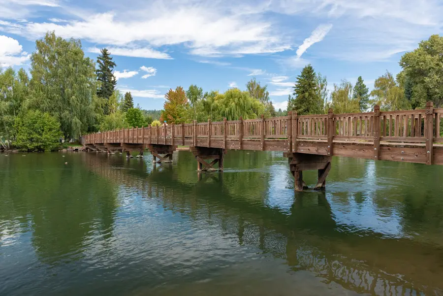
At 237 acres, Old Bend is by far the smallest of the 13 districts, and the most concentrated slice of old Bend there is: Drake Park, the Deschutes at Mirror Pond, Franklin and Arizona avenues, and blocks of early-1900s houses under big ponderosas. Everything downtown is a few minutes on foot, and the river trail runs right through the park.
Housing, schools, parks, transit & food
Where it is
South-central Bend, the City’s “business core” district: Drake Park and the river east to the downtown blocks around Franklin and Arizona. The north half of downtown (Wall and Bond around Oregon Avenue) is in River West on the City’s map.
Housing
Early-1900s bungalows and craftsman houses, some converted to offices, plus condos and newer infill near downtown. Few lots come up for sale, and many are small.
Schools
Amity Creek Magnet at Thompson sits inside the district. Neighborhood school assignment depends on your side of the river, so check the address.
In the district: Amity Creek Magnet at Thompson, Bend Montessori School (private)
Parks & trails
Drake Park’s half mile of riverfront, Mirror Pond and the Deschutes River Trail. Bikes reach the Old Mill and westside in minutes.
Drake Park (13 acres, riverfront) · Mary Jane’s Park · Miller’s Landing Park
Getting around
Routes 2 and 11 stop in the district; every other Bend route meets at Hawthorne Station, a short walk east.
Dining & groceries
All of downtown: Wall and Bond restaurants, bars, the Tower Theatre, McMenamins Old St. Francis School. Market of Choice is at the district’s south end.
Who it suits
People who want to walk to dinner and the river and don’t need a big yard. Downtown workers. Visitors who want to park once.
Trade-offs
Event and summer weekend crowds around Drake Park
Very little inventory and premium prices
Older houses can mean older wiring, foundations and drafty windows
Visiting? McMenamins Old St. Francis School and the Mill Inn are inside the district; the Oxford Hotel and Wall Street Suites are a few blocks north.
Short-term rentals: Residential and Mixed Use Riverfront zones here fall under the 500-foot spacing rule for whole-house rentals.
Galveston, Newport, the whitewater park and the north half of downtown.
Walk to dinner
Trails & river
Young professionals
Historic character
Where to stay
On the bus line
Typical home
$869K +1.9% / yr
Size
1,459 acres
To downtown
4 min · 1.1 mi
To Mt. Bachelor
41 min
High school
Summit (most addresses)
Bus routes
2, 3, 11
WalkBikeOutdoors
When locals say “the westside,” they usually mean River West. It has more restaurants, cafes and bars mapped inside it than any other district by a wide margin, from the Galveston and 14th Street strip to Newport Avenue. It also takes in the north half of downtown (Wall Street, the Tower Theatre, the Oxford Hotel), the river from Mirror Pond up past McKay Park, the Bend Whitewater Park, and COCC’s campus on the flank of Awbrey Butte.
Housing, schools, parks, transit & food
Where it is
West Bend along the Deschutes. On the City’s map it reaches east across the river to take in the downtown blocks around Wall, Bond and Oregon, and west to Galveston, Newport and 14th Street.
Housing
Older westside bungalows and cottages near the river and Galveston, mid-century ranches farther west, and a steady stream of infill townhomes, ADUs and condos.
Schools
Two magnet elementaries sit inside the district; most addresses are in Summit High’s area.
In the district: Highland Magnet at Kenwood, Westside Village Magnet at Kingston, Central Oregon Community College
Parks & trails
Float or surf the whitewater park, run the Deschutes River Trail, and bike Galveston west toward Shevlin Park and the trails off Skyliners Road.
McKay Park and the Bend Whitewater Park · Columbia Park · Harmon Park · Hixon Park · Pioneer Park · Riverview Park · Sunset View Park
Getting around
Routes 2, 3 (Newport) and 11 (Galveston / 14th): 25 stops in the district.
Dining & groceries
The densest restaurant cluster in Bend: Galveston Avenue, 14th Street and Newport Avenue, plus downtown’s north blocks. Newport Avenue Market is the neighborhood grocery.
Who it suits
People who want restaurants, coffee and the river in the same walk. Cyclists, paddlers, young professionals, empty-nesters downsizing.
Trade-offs
Galveston and Newport get busy, and parking near the river fills in summer
Block-to-block walkability changes fast as you climb west
Strong demand keeps prices high
Visiting? The Oxford Hotel, Wall Street Suites, Element and DoubleTree are on the downtown side; a few vacation rentals sit near the river.
Short-term rentals: Whole-house rentals in residential zones need a Type II permit and 500 feet from the next one, so many blocks are already full.
NorthWest Crossing, Discovery West and the road to Shevlin Park.
Trails & river
Families
Newer homes
Typical home
$1.10M −1.1% / yr
Size
1,553 acres
To downtown
8 min · 2.9 mi
To Mt. Bachelor
42 min
High school
Summit
Bus routes
3
WalkBikeOutdoors
Summit West is the district that contains NorthWest Crossing and Discovery West, the neighborhoods along Shevlin Park Road, and the forested edge running out toward Shevlin Park and the Deschutes National Forest. Four public schools sit inside it (Summit High, Pacific Crest Middle, High Lakes and Miller elementaries), along with a long list of parks.
Housing, schools, parks, transit & food
Where it is
Northwest Bend: NorthWest Crossing, the neighborhoods along Shevlin Park Road, and the areas extending west toward Shevlin Park and the national forest.
Housing
Planned-neighborhood cottages, townhomes and detached homes in NWX and Discovery West; larger homes on wooded lots toward Shevlin Park; apartments near the NWX core.
Schools
Summit High, Pacific Crest Middle, High Lakes Elementary and William E. Miller Elementary are all inside the district.
In the district: Summit High, Pacific Crest Middle, High Lakes Elementary, William E. Miller Elementary, The Montessori Center (private)
Parks & trails
Shevlin Park’s 6-mile loop and Tumalo Creek trails, the Mrazek connection into the forest, and a short ride to the Phil’s Trail network.
Shevlin Park (981 acres) just beyond the edge · Compass Park · Discovery Park · Overturf Butte off-leash area · Lewis & Clark Park · Pacific Crest Athletic Fields · Rim Rock Natural Area
Getting around
Route 3 reaches NorthWest Crossing (4 stops in the district). Most of Summit West is car and bike country.
Dining & groceries
NWX’s town center on NW Crossing Drive for coffee, restaurants, a specialty market and the seasonal farmers market; Galveston is a short ride east.
Who it suits
Families who want schools within walking or biking distance, trail runners and mountain bikers, westside commuters.
Trade-offs
Some of Bend’s highest home values
Forest edge means wildfire prep and defensible space matter
Winter driving on Shevlin Park Road and the hills
Wildfire: The district’s western edge borders Shevlin Park and national forest. Summit West residents have organized Firewise USA groups and neighbor-to-neighbor wildfire assessments.
Century Drive, OSU-Cascades and the shortest drive to Mt. Bachelor.
Trails & river
Views & space
Where to stay
Typical home
$1.05M −0.2% / yr
Size
1,544 acres
To downtown
8 min · 2.9 mi
To Mt. Bachelor
38 min
High school
Summit
Bus routes
11
WalkBikeOutdoors
Century West runs along the Century Drive corridor, the road to Mt. Bachelor and the Cascade Lakes. It includes the OSU-Cascades campus, Mount Bachelor Village Resort, the Broken Top golf community and the Tetherow area at its western edge. From the middle of the district it is about 38 minutes to Mt. Bachelor’s West Village with no traffic, the quickest of any district.
Housing, schools, parks, transit & food
Where it is
Southwest Bend, from the Tetherow area east toward SW Century Drive and south toward the Brookswood corridor.
Housing
Resort condos and townhomes (Mount Bachelor Village), golf-community homes at Broken Top and Tetherow, single-family subdivisions off Century Drive and Mt. Washington Drive, and student housing near OSU-Cascades.
Schools
Cascade Middle School and the private Seven Peaks School are inside the district.
In the district: Cascade Middle School, Seven Peaks School (private), OSU-Cascades
Parks & trails
Phil’s Trail network, the Deschutes River Trail upstream of town, and Century Drive straight to Mt. Bachelor and the Cascade Lakes.
Skyline Sports Complex · Haul Road Trail · Deschutes River Trail access along the canyon
Getting around
Route 11 serves the district’s east side (3 stops). Winter ski buses to Mt. Bachelor run from Bend.
Dining & groceries
Restaurants and pubs along Century Drive and around Mount Bachelor Village; groceries are in Southern Crossing or on Newport.
Who it suits
Skiers, mountain bikers, river runners, OSU-Cascades students and staff, second-home owners.
Trade-offs
Powder mornings and summer weekends back up Century Drive
Wildfire prep matters on the forested west and south edges
Fewer walkable errands
Visiting? Mount Bachelor Village Resort sits inside the district; Seventh Mountain Resort and Tetherow’s lodges are just west on Century Drive.
Wildfire: The 1990 Awbrey Hall Fire burned more than 3,350 acres and 22 homes on Bend’s west side. Pine-and-manzanita lots along the canyon and Tetherow edge need defensible space.
Short-term rentals: Mount Bachelor Village and the Courtyards at Broken Top (units 1-8 and 21-32) are exempt from the City’s land-use permit for short-term rentals.
Official districtWestside
Awbrey Butte: Views, Hills and Privacy
Hillside homes over the river and downtown, with the highest home values in Bend.
Views & space
Quiet & residential
Retirees
Typical home
$1.15M −0.1% / yr
Size
2,273 acres
To downtown
9 min · 3 mi
To Mt. Bachelor
47 min
High school
Summit (most addresses)
Bus routes
None
WalkBikeOutdoors
Awbrey Butte is hillside Bend: winding roads, wooded lots and some of the best views of the Cascades in town. It is centered on Awbrey Butte, the Awbrey Glen golf community and River’s Edge, and it carries the highest typical home value of the 13 districts. It is also the only district with no bus stop, and one of two (with Southeast Bend) with no restaurants mapped inside it.
Housing, schools, parks, transit & food
Where it is
The hillside in northwest Bend centered on Awbrey Butte, Awbrey Glen and River’s Edge, overlooking the Deschutes and downtown and extending west toward the upland forest and trails.
Housing
Custom homes on large, often steep wooded lots; golf-course homes at Awbrey Glen and River’s Edge; a few townhome enclaves.
Schools
No public schools sit inside the district; most addresses are in Summit High’s area.
Parks & trails
River access at First Street Rapids and the trail north to Sawyer Park, plus a quick drive to Shevlin Park.
Sawyer Uplands Park · Awbrey Village Park · First Street Rapids Park · Summit Park · Sylvan Park
Getting around
No bus stops inside the district. Plan on a car.
Dining & groceries
Nothing mapped on the butte itself. Newport Avenue Market and Galveston are about 10 minutes down the hill.
Who it suits
People who want privacy, views and space more than a walk to coffee. Golfers. Retirees who don’t mind driving.
Trade-offs
Steep streets and driveways in snow and ice
Wildfire risk in wooded hillside settings
Car-dependent for every errand
Visiting? The Riverhouse on the Deschutes hotel sits at the district’s northeast corner on the river.
Wildfire: Wooded hillside lots and canyon edges make defensible space a real chore here. The 1990 Awbrey Hall Fire is the reason many west-side homeowners take it seriously.
Southern Crossing: River, Old Mill and Central Access
The Old Mill District, the amphitheater and the river parks, in the middle of town.
Walk to dinner
Trails & river
Where to stay
Young professionals
On the bus line
Typical home
$771K −0.1% / yr
Size
883 acres
To downtown
6 min · 2 mi
To Mt. Bachelor
39 min
High school
Bend High or Summit (check address)
Bus routes
2, 11
WalkBikeOutdoors
Southern Crossing spans the Deschutes in central Bend and holds the Old Mill District, the Box Factory, Hayden Homes Amphitheater, the Southern Crossing bridge and two of Bend’s best river parks, Riverbend and Farewell Bend. It is the most central district on a map, about 6 minutes from downtown.
Housing, schools, parks, transit & food
Where it is
Central Bend, spanning the Deschutes: bordered by Colorado and Simpson avenues, Highway 97, Powers Road and the river along Century Drive.
Housing
Apartments and condos around the Old Mill, older small homes east of the river, townhomes and newer infill, and riverside homes near Farewell Bend.
Schools
Deschutes River Montessori (private) is inside the district; public assignment depends on the address.
In the district: Deschutes River Montessori (private)
Parks & trails
The Deschutes River Trail on both banks, the summer float from Riverbend Park to Drake Park, and a fast ride to Century Drive.
Riverbend Park · Farewell Bend Park · Blakely Park · Woodriver Park
Getting around
Routes 2 and 11 (14 stops in the district).
Dining & groceries
Old Mill District restaurants and shops, the Box Factory, and a Safeway inside the district.
Who it suits
Concertgoers, floaters, people who want central access without living downtown, renters.
Visiting? Most of Bend’s chain hotels cluster here: Hilton Garden Inn, Residence Inn, SpringHill Suites, TownePlace Suites, Hampton and Cambria, plus the Pine Ridge Inn.
Short-term rentals: Mixed Use Riverfront properties inside the Old Mill District are excluded from the 500-foot spacing rule; residential blocks are not.
Official districtSouth Bend
Southwest Bend: Quiet Southside Pockets
Subdivisions between the river canyon and Highway 97, with Sunriver-direction errands.
Families
Quiet & residential
Lower price
Typical home
$711K +0.3% / yr
Size
1,590 acres
To downtown
10 min · 4.2 mi
To Mt. Bachelor
44 min
High school
Caldera (most addresses)
Bus routes
1, 2, 30
WalkBikeOutdoors
Southwest Bend sits between the Deschutes River and Highway 97 on the south side. It is mostly neighborhoods built from the 1990s on, with River Rim along the canyon, two elementary schools, a lot of playgrounds and the big-box shopping on south Highway 97 and Third Street.
Housing, schools, parks, transit & food
Where it is
South Bend, between the Deschutes River and Highway 97.
Housing
Single-family subdivisions, many from the 1990s and 2000s, plus some townhomes; canyon-edge homes around River Rim.
Schools
Elk Meadow and Pine Ridge elementary schools are inside the district.
In the district: Elk Meadow Elementary, Pine Ridge Elementary
Parks & trails
The river canyon and Deschutes River Trail access on the west edge; the Haul Road and Phil’s area are a short drive.
River Rim Park · River Canyon Park · Pine Ridge Park · Hollygrape Park · Wildflower Park · Renaissance Ridge Central Park
Getting around
Routes 1 (South Third) and 2, plus the La Pine commuter route 30 (18 stops in the district).
Dining & groceries
Walmart, Albertsons and the chains along south Third Street and Highway 97; few sit-down restaurants within walking distance.
Who it suits
Families wanting a yard and schools nearby, commuters toward Sunriver or La Pine, people who prefer quiet streets.
Trade-offs
No single walkable center
Highway 97 and Third Street traffic
Edge-of-canyon lots need wildfire prep
Official districtSouth Bend
Southeast Bend: Newer Growth and Open Edges
Caldera High, Alpenglow Park and Bend’s newest southeast subdivisions.
Newer homes
Families
Lower price
Quiet & residential
Typical home
$676K ±0.0% / yr
Size
1,286 acres
To downtown
11 min · 4.8 mi
To Mt. Bachelor
47 min
High school
Caldera
Bus routes
9
WalkBikeOutdoors
Southeast Bend is where the city’s growth is easiest to see. Caldera High opened here in 2021, Alpenglow Community Park (37 acres, with a bouldering area, sprayground and off-leash area) anchors the neighborhoods, and new subdivisions keep filling in toward the edge. The new Deschutes Public Library Central Library, which opened in May 2026, is just to the northeast in the Stevens Ranch area.
Housing, schools, parks, transit & food
Where it is
South Bend, east of Highway 97.
Housing
Mostly newer single-family homes and townhomes, many built in the last decade, with more under construction.
Schools
Caldera High School is inside the district.
In the district: Caldera High School
Parks & trails
Open high-desert edges, Alpenglow’s 3.5 miles of paths, and a straight shot south toward Lava Butte and Newberry.
Alpenglow Community Park (37 acres)
Getting around
Route 9 (15th Street / Murphy Road), 4 stops in the district.
Dining & groceries
Few restaurants inside the district; groceries are on Third Street and in Old Farm (Fred Meyer).
Who it suits
Buyers who want a newer house and a yard, families with high-schoolers, east and south commuters.
Trade-offs
Longer trips to downtown and the westside
Construction and changing road patterns as it builds out
Few walkable errands yet
Official districtEastside
Old Farm District: Residential South and Southeast Bend
Stone Creek, The Bridges and Foxborough between Reed Market and Murphy.
Families
Lower price
Quiet & residential
Typical home
$620K −2.4% / yr
Size
2,064 acres
To downtown
10 min · 4 mi
To Mt. Bachelor
47 min
High school
Caldera or Bend High (check address)
Bus routes
1, 6, 9, 30
WalkBikeOutdoors
Old Farm covers a broad residential swath of the southeast side, from Reed Market Road south to Murphy Road. It is mostly subdivisions with their own parks and playgrounds (Stone Creek, The Bridges, Foxborough), two elementary schools and a Fred Meyer, without one obvious center.
Housing, schools, parks, transit & food
Where it is
Roughly between Highway 97 on the west, 27th Street on the east, Reed Market Road on the north and Murphy Road on the south.
Housing
Single-family subdivisions from the 1990s onward, some with HOA pools and parks; townhomes and apartments near Third Street and 15th Street.
Schools
R.E. Jewell and Silver Rail elementary schools are inside the district.
In the district: R.E. Jewell Elementary, Silver Rail Elementary
Parks & trails
Neighborhood parks and canal trails; the Larkspur Trail and Pilot Butte are a short ride north.
Bridges Community Park · Stone Creek Park · Foxborough Park · Sun Meadow Park · Ridgewater Natural Area
Getting around
Routes 1, 6 and 9 plus the La Pine route 30 (20 stops).
Dining & groceries
Fred Meyer, the Vegetable Man produce stand and Third Street restaurants; food is a drive or bike, not a walk, for most homes.
Who it suits
Families wanting a yard, HOA amenities and an elementary nearby; people who work on the east or south side.
Trade-offs
Car-oriented street layout
Reed Market and 27th Street congestion at rush hour
Home values dipped 2.4% in the last year
Official districtEastside
Larkspur: Trails and Established East Bend
The Larkspur Trail, Bend High and one of the lower-priced districts.
Lower price
On the bus line
Families
Trails & river
Typical home
$558K −0.5% / yr
Size
1,917 acres
To downtown
7 min · 2.6 mi
To Mt. Bachelor
45 min
High school
Bend High
Bus routes
1, 5, 6, 7, 9
WalkBikeOutdoors
Larkspur runs from Highway 20 and Franklin south to Reed Market, between Highway 97 and just past 27th Street. Its signature is the Larkspur Trail, a 3.9-mile paved-and-gravel path from Larkspur Park north to Neff Road that links Pilot Butte, the canal trail and a string of parks. Bend Senior High and Bear Creek Elementary are inside the district.
Housing, schools, parks, transit & food
Where it is
From Highway 20 and Franklin Avenue on the north to Reed Market Road on the south, Highway 97 on the west to just past 27th Street on the east.
Housing
Mid-century and 1970s-90s single-family homes on regular lots, duplexes and apartments, and newer infill along the arterials.
Schools
Bend Senior High and Bear Creek Elementary are inside the district.
In the district: Bend Senior High, Bear Creek Elementary
Parks & trails
The Larkspur Trail to Pilot Butte’s summit, the Coyner Trail to Juniper Park, and two off-leash areas.
Larkspur Park · Kiwanis Park · Jaycee Park · Ponderosa Park · Gardenside Park
Getting around
Five routes (1, 5, 6, 7, 9) and 29 stops: one of the best-served districts.
Dining & groceries
Third Street and 27th Street restaurants and food carts, Grocery Outlet; Midtown and downtown are a short bike ride.
Who it suits
First-time buyers, families who want Bend High nearby, people who ride the bus or bike to work.
Trade-offs
Third Street and 27th Street traffic and noise
Walkability varies a lot by pocket
Mixed housing condition
Visiting? Budget motels and the Home2 Suites line south Third Street on the district’s west edge.
Midtown, Pilot Butte, Juniper Park and the bus hub, east of downtown.
On the bus line
Young professionals
Lower price
Walk to dinner
Typical home
$589K +1.8% / yr
Size
1,358 acres
To downtown
6 min · 2 mi
To Mt. Bachelor
45 min
High school
Bend High or Mountain View (check address)
Bus routes
1, 2, 3, 4, 5, 6, 7, 8, 9, 11
WalkBikeOutdoors
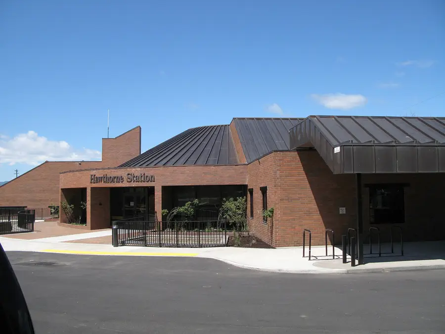
The Orchard District is bordered by Pilot Butte, the railroad and the Highway 97 Parkway, Franklin Avenue and Butler Market Road. It includes Midtown, the Bend Central District redevelopment area, Juniper and Hollinshead parks, Pilot Butte State Scenic Viewpoint and Hawthorne Station, where every Bend bus route meets.
Housing, schools, parks, transit & food
Where it is
East-central Bend between Pilot Butte, the railroad and Parkway, Franklin Avenue and Butler Market Road.
Housing
Older small houses and bungalows, 1970s ranches, new townhomes and apartments in the Bend Central District, and a lot of ADUs and infill.
Schools
Juniper Elementary and Pilot Butte Middle are inside the district.
In the district: Juniper Elementary, Pilot Butte Middle
Parks & trails
A daily Pilot Butte summit hike from your door, the Larkspur Trail and the canal trails.
Pilot Butte State Scenic Viewpoint · Juniper Park and Juniper Swim & Fitness · Hollinshead Park · Canal Row Park · Orchard Park
Getting around
Hawthorne Station is here: all ten Bend routes plus the Redmond, Sisters and La Pine commuters (35 stops).
Dining & groceries
Third Street, Greenwood and Midtown food carts, breweries and diners; Albertsons, Safeway and Colima Market.
Who it suits
Young professionals, bus riders, people who want central and eclectic over polished, investors in infill.
Trade-offs
Sidewalks come and go
Third Street and Greenwood traffic
Redevelopment changes blocks quickly
Visiting? The Campfire Hotel and a row of older motels on Third Street.
St. Charles, Mountain View High and the lowest typical home value of the 13 districts.
Lower price
Families
Retirees
On the bus line
Typical home
$540K −2.0% / yr
Size
1,825 acres
To downtown
10 min · 3.4 mi
To Mt. Bachelor
51 min
High school
Mountain View
Bus routes
5, 6, 7, 8
WalkBikeOutdoors
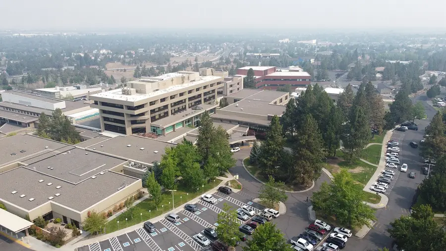
Mountain View is northeast Bend between Pine Nursery Park and Highway 20 along the eastern city edge. St. Charles Bend, the region’s main hospital, sits inside it, along with Mountain View High, Ensworth Elementary and two grocery stores. Its typical home value is the lowest of the 13 districts.
Housing, schools, parks, transit & food
Where it is
Northeast Bend between Pine Nursery Park and U.S. Highway 20, along the eastern edge of the city.
Housing
Single-family subdivisions from the 1970s through 2000s, newer homes on the east edge, apartments near Neff Road and the hospital.
Schools
Mountain View High and Ensworth Elementary are inside the district, plus two private schools.
In the district: Mountain View High, Ensworth Elementary, St. Francis of Assisi School (private), Trinity Lutheran School (private)
Parks & trails
Pine Nursery’s 14-acre off-leash area, pickleball complex and disc golf, and Big Sky Park on the east edge.
Al Moody Park · Mountain View Park · Eagle Park · Pine Nursery Park (159 acres) next door · Big Sky Park on the east edge
Getting around
Routes 5, 6, 7 and 8 (25 stops), with 15-minute weekday service on busy segments near St. Charles and Neff Road.
Dining & groceries
Safeway and Whole Foods, restaurants around Neff and 27th Street, and the food carts and taprooms on the eastside.
Who it suits
Healthcare workers, families who want a lower price, people who live their week on the east side.
Trade-offs
Car-oriented for most errands
Long trip to the westside trails and Mt. Bachelor (about 51 minutes to West Village)
Typical home value fell 2% in the last year
Official districtNorth Bend
Boyd Acres: North Bend Variety
Big, mixed and closest to Redmond and the airport.
Lower price
Families
Newer homes
Typical home
$589K −2.0% / yr
Size
2,390 acres
To downtown
9 min · 3.8 mi
To Mt. Bachelor
49 min
High school
Mountain View
Bus routes
4, 8
WalkBikeOutdoors
Boyd Acres is the largest district at 2,390 acres, running from the Deschutes River east to the city edge and from Cooley Road south to Butler Market Road. It mixes subdivisions, apartments, the Cascade Village shopping area, light industry and a riverfront park. It is the closest district to Redmond Airport, about 22 minutes away.
Housing, schools, parks, transit & food
Where it is
Northeast Bend from the Deschutes River on the west to the eastern city edge, and from Cooley Road on the north to Butler Market Road on the south.
Housing
Every type: 1970s-90s ranches, newer subdivisions on the north and east, apartments near Third Street, and a few larger lots near the river.
Schools
Lava Ridge, North Star and Ponderosa elementaries and Sky View Middle are inside the district.
In the district: Lava Ridge Elementary, North Star Elementary, Ponderosa Elementary, Sky View Middle, Bend International School (charter)
Parks & trails
Sawyer Park and the river trail on the west edge; Pine Nursery and Shevlin Park are each about 10 minutes away.
Sawyer Park on the Deschutes · Boyd Park · Empire Crossing Park · Harvest Park · Northpointe Park
Getting around
Routes 4 (North Third, 15-minute midday service on weekdays) and 8, plus the Redmond and Sisters commuters (21 stops).
Dining & groceries
Trader Joe’s, WinCo and Natural Grocers, the Third Street and Cascade Village chains, and breweries in the north-end industrial parks.
Who it suits
Redmond and airport commuters, buyers who want more house for the money, families.
Trade-offs
Auto-oriented, without one walkable center
Highway 97 and Third Street traffic
Typical home value fell 2% in the last year
Visiting? Chain hotels and motels along north Third Street and Highway 97.
Wall and Bond streets, Mirror Pond and the Tower Theatre.
Walk to dinner
Where to stay
Historic character
Young professionals
On the bus line
Typical home
Typical values: River West $869K, Old Bend $870K
To downtown
You’re in it
To Mt. Bachelor
41 min
High school
Bend High or Summit (check address)
Bus routes
2, 3, 11
WalkBikeOutdoors
Downtown is a local name, not a district. On the City’s map its blocks are split: Wall and Bond around Oregon and Minnesota avenues (the Tower Theatre, the Oxford Hotel) are in River West, while Franklin, Arizona and Drake Park are in Old Bend. For living, “downtown” usually means condos above shops or the historic houses a few blocks away.
Housing, schools, parks, transit & food
Where it is
Wall Street, Bond Street and the blocks between Mirror Pond and the railroad, roughly from Portland Avenue south to Arizona Avenue.
Housing
Condos and lofts above shops, a few historic homes and apartments; most single-family homes are in the surrounding Old Bend and River West blocks.
Schools
Amity Creek Magnet at Thompson is at downtown’s south end.
Parks & trails
River trail along Mirror Pond; the whitewater park and Old Mill are a short walk.
Drake Park · Mirror Pond · Brooks Park · Troy Field
Getting around
Downtown stops for routes 2, 3 and 11; Hawthorne Station is about half a mile east.
Dining & groceries
Bend’s main restaurant and bar district, the Tower Theatre, Deschutes Brewery’s original public house, and the Downtown Bend Library.
Who it suits
Visitors, downsizers who want to walk everywhere, people who don’t want a yard.
Trade-offs
Festival and parade weekends close streets
Paid and limited parking
Very few homes for sale
Visiting? The Oxford Hotel, McMenamins Old St. Francis School, Wall Street Suites, the DoubleTree and a handful of boutique inns.
Local areain Summit WestWestside
NorthWest Crossing: Planned Walkability and Westside Access
Bend’s best-known planned neighborhood, with a real town center.
Walk to dinner
Trails & river
Families
Newer homes
Young professionals
Typical home
Summit West typical value: $1.10M
To downtown
7 min · 2.1 mi
To Mt. Bachelor
42 min
High school
Summit
Bus routes
3
WalkBikeOutdoors
NorthWest Crossing (NWX) is a new-urbanist neighborhood of about 486 acres on the former Miller family land, developed by Brooks Resources and partners starting in the late 1990s. It was planned around a walkable center on NW Crossing Drive, with Compass Park and its seasonal farmers market at the heart, the 40-acre Discovery Park, and about 1,335 homes at build-out. It sits inside the Summit West district.
Housing, schools, parks, transit & food
Where it is
Inside Summit West, around NW Crossing Drive and Mt. Washington Drive between Shevlin Park Road and Skyliners Road.
Housing
Cottages, rowhouses, live-work units, apartments and detached homes on small lots with alleys.
Schools
Summit High, Pacific Crest Middle, High Lakes Elementary and Miller Elementary are all in or next to the neighborhood.
Parks & trails
Trails from the front door; Shevlin Park and Phil’s Trail are minutes by bike.
Compass Park · Discovery Park · Lewis & Clark Park · Overturf Butte off-leash area
Getting around
Route 3 was extended into NorthWest Crossing after rider feedback.
Dining & groceries
Restaurants, coffee and a specialty seafood market in the town center; the seasonal NWX farmers market at Compass Park.
Who it suits
Families who want kids to walk to school, active people who want trails and a coffee shop in the same walk.
Trade-offs
Small lots and close neighbors by design
Some of the highest prices in Bend
HOA design rules
Local areain Summit WestWestside
Discovery West: Newer Westside Bend
The 245-acre follow-up to NWX, still building out.
Newer homes
Trails & river
Families
Typical home
Summit West typical value: $1.10M; new construction often higher
To downtown
8 min · 3.1 mi
To Mt. Bachelor
41 min
High school
Summit
Bus routes
None
WalkBikeOutdoors
Discovery West is a 245-acre neighborhood just west of NorthWest Crossing, from the same team (NWX2 LLC, with Brooks Resources as managing member). Plans call for about 650 homes across estate lots, single-family homes, townhomes, cottages and apartments, with Discovery Park’s trails and a small retail plaza at Discovery Corner.
Housing, schools, parks, transit & food
Where it is
Inside Summit West, immediately west of NorthWest Crossing and north of Summit High School.
Housing
New construction: estate lots, custom and single-family homes, townhomes, cottages, live-work units and apartments.
Schools
Three public schools are nearby (Summit High, Pacific Crest Middle, Miller Elementary).
Parks & trails
Direct access to the westside forest edge, Shevlin Park and the Phil’s network.
Discovery Park · Shevlin Park beyond the edge
Getting around
No bus stops inside yet; Route 3 serves NorthWest Crossing next door.
Dining & groceries
Small retail and dining spaces at Discovery Corner; NWX’s town center is a few minutes away.
Who it suits
Buyers who want brand-new construction on the westside and don’t mind living near active building.
Trade-offs
Ongoing construction noise and changing streets
Wildfire prep on the forest edge
Premium new-construction pricing
Wildfire: It is the westernmost neighborhood in this part of Bend, next to the Shevlin Park forest.
The old lumber-mill site, now shops, trails and the amphitheater.
Walk to dinner
Where to stay
Trails & river
Young professionals
Typical home
Southern Crossing typical value: $771K
To downtown
4 min · 1.2 mi
To Mt. Bachelor
41 min
High school
Bend High or Summit (check address)
Bus routes
2, 11
WalkBikeOutdoors
The Old Mill District is the redeveloped lumber-mill site on the Deschutes, recognizable by its three smokestacks (the old powerhouse is now an REI). It has shopping, restaurants, a movie theater, the Hayden Homes Amphitheater and riverbank trails on both sides. It is inside the Southern Crossing district.
Housing, schools, parks, transit & food
Where it is
Inside Southern Crossing, on both banks of the Deschutes between Colorado Avenue and Reed Market Road.
Housing
Apartments and condos in and around the district, with older homes and newer townhomes on the surrounding blocks.
Schools
Check the address: the area sits near the Bend High / Summit boundary along the river.
Parks & trails
Float the Deschutes in summer, walk the river loop, bike to Century Drive.
Riverbend Park · Farewell Bend Park · McKay Park across the river
Getting around
Routes 2 and 11 stop nearby; CET’s seasonal Ride the River shuttle serves the summer float.
Dining & groceries
Restaurants and shops along the river, the Box Factory just north.
Who it suits
Visitors, concert fans, renters who want the river and shops without downtown parking.
Trade-offs
Concert nights and summer river crowds
Retail-district feel rather than a residential street
Visiting? Most of Bend’s chain hotels are within a few blocks.
Greenwood, Third Street and the food-cart pods east of downtown.
Young professionals
On the bus line
Lower price
Walk to dinner
Typical home
Orchard District typical value: $589K
To downtown
4 min · 1 mi
To Mt. Bachelor
44 min
High school
Bend High or Mountain View (check address)
Bus routes
1, 2, 3, 4, 5, 6, 7, 8, 9, 11
WalkBikeOutdoors
Midtown is a widely used local name for the central northeast part of Bend, and the City places it inside the Orchard District. It covers the blocks around Greenwood Avenue, Third and Fourth streets and Franklin, with older houses, new apartments in the Bend Central District, food carts, breweries and the Hawthorne Station bus hub.
Housing, schools, parks, transit & food
Where it is
Inside the Orchard District, east of the railroad and downtown, around Greenwood, Third Street and Franklin.
Housing
Small older houses, duplexes, new apartment buildings and townhomes.
Schools
Juniper Elementary and Pilot Butte Middle are nearby.
Parks & trails
Pilot Butte’s summit trail and the Larkspur Trail.
Juniper Park · Hollinshead Park · Pilot Butte
Getting around
Hawthorne Station: every Bend route.
Dining & groceries
Food-cart pods, breweries, diners and coffee along Third and Greenwood.
Who it suits
Young professionals, bus riders and anyone who wants to be central on a budget.
Golf-course communities on the forested southwest edge, closest to Mt. Bachelor.
Views & space
Trails & river
Retirees
Quiet & residential
Typical home
Century West typical value: $1.05M; custom homes here often sell well above that
To downtown
10 min · 3.9 mi
To Mt. Bachelor
38 min
High school
Summit
Bus routes
None
WalkBikeOutdoors
Tetherow and Broken Top are the two big golf communities on Bend’s southwest edge, off Century Drive and Mt. Washington Drive. The City describes Century West as extending from the Tetherow area; Broken Top falls inside the district. Tetherow has resort lodges and a golf course; the Broken Top Club is private. From either one, Mt. Bachelor’s West Village is about 38 minutes with no traffic.
Housing, schools, parks, transit & food
Where it is
Off Century Drive and SW Mt. Washington Drive at Bend’s southwest edge.
Housing
Custom homes, golf villas and townhomes; Tetherow also has resort lodging.
Schools
Summit High’s attendance area includes Tetherow and Broken Top.
Parks & trails
Golf, Phil’s Trail and the quickest route to the mountain and the Cascade Lakes.
Phil’s Trail network · Deschutes River Trail
Getting around
No regular bus service; drive or bike.
Dining & groceries
Clubhouse and resort restaurants; groceries are down Century Drive.
Who it suits
Golfers, skiers, second-home owners, retirees who want space and amenities.
Trade-offs
HOA fees and design rules
Wildfire prep on the forest edge
Car-dependent
Visiting? Tetherow’s lodges; Mount Bachelor Village and Seventh Mountain Resort are nearby on Century Drive.
Wildfire: Both sit against pine forest on the city’s southwest edge, so defensible space and evacuation planning matter.
Short-term rentals: The Courtyards at Broken Top units 1-8 and 21-32 are exempt from the City’s short-term rental land-use permit.
Just outside the city limits
Outside the cityOutside city limits
Deschutes River Woods: Wooded Lots South of Town
Unincorporated pine-forest neighborhood of about 5,500 people.
Quiet & residential
Trails & river
Lower price
Typical home
No separate index; the 97702 ZIP (most of south Bend) is $676K
To downtown
15 min · 7.3 mi
To Mt. Bachelor
51 min
High school
Caldera (check address)
Bus routes
None
WalkBikeOutdoors
Deschutes River Woods is an unincorporated community south of the city limits and west of Highway 97, with 5,532 residents in the 2020 census. Homes sit on larger wooded lots along the Deschutes River side of the highway. Deschutes County, not the City of Bend, handles land use and permits.
Housing, schools, parks, transit & food
Where it is
Unincorporated Deschutes County, south of Bend’s city limits, west of Highway 97.
Housing
Single-family and manufactured homes on larger forested lots. Ask about water source and septic on any listing.
Schools
Bend-La Pine Schools. Check the address in Deschutes County’s DIAL tool.
Parks & trails
Forest at the back door and the river nearby.
Deschutes River access on the west side · Lava Butte and Newberry National Volcanic Monument to the south
Getting around
No Bend fixed-route bus; the La Pine-Bend route 30 runs on Highway 97.
Dining & groceries
Drive into south Bend for groceries and restaurants (about 15 minutes to downtown).
Who it suits
People who want space, trees and fewer neighbors and are fine with county services.
Trade-offs
Wildfire risk is real in the pines
Water and septic details vary by lot
Longer drives for everything
Wildfire: Lots sit in continuous ponderosa and lodgepole forest. Check evacuation zones and defensible space before buying.
Short-term rentals: Outside the city, Deschutes County rules apply, not the City of Bend’s short-term rental code.
Outside the cityOutside city limits
Three Rivers: South County, Near Sunriver
Unincorporated forest subdivisions south of Sunriver, about 30 minutes from Bend.
Quiet & residential
Trails & river
Typical home
97707 ZIP (Sunriver / Three Rivers area): $723K; Sunriver median sale $860K in September
To downtown
30 min · 20.6 mi
To Mt. Bachelor
44 min
High school
La Pine or Caldera (check address)
Bus routes
None
WalkBikeOutdoors
Three Rivers is an unincorporated area south of Sunriver, about 30 minutes and 21 miles from downtown Bend. It is forest subdivisions near the Deschutes and Little Deschutes rivers, with Sunriver’s shops, airport and resort a few minutes away. Bend-La Pine Schools runs Three Rivers K-8 there.
Housing, schools, parks, transit & food
Where it is
Unincorporated Deschutes County, south of Sunriver off Highway 97.
Housing
Cabins, single-family homes and second homes on forested lots. Ask about water source and septic on any listing.
Schools
Three Rivers K-8 (Bend-La Pine Schools). High school depends on the address: La Pine High, or a Caldera / La Pine choice area. Check DIAL.
Parks & trails
Rivers, forest and a short drive to Mt. Bachelor (about 44 minutes) and the Cascade Lakes.
Deschutes and Little Deschutes rivers · Sunriver bike paths nearby
Getting around
No Bend bus service; the La Pine-Bend route 30 runs along Highway 97.
Dining & groceries
Sunriver Village for groceries and restaurants.
Who it suits
Second-home buyers, remote workers, people who want forest quiet near Sunriver.
Trade-offs
Long commute into Bend
Wildfire risk in lodgepole forest
County services only
Wildfire: Continuous forest on all sides: defensible space and evacuation planning are part of owning here.
Short-term rentals: Deschutes County rules apply, not the City of Bend’s.
A small farm community on the Deschutes, 12 minutes from downtown.
Quiet & residential
Views & space
Typical home
No separate index; acreage properties vary widely
To downtown
12 min · 7.2 mi
To Mt. Bachelor
52 min
High school
Redmond School District
Bus routes
None
WalkBikeOutdoors
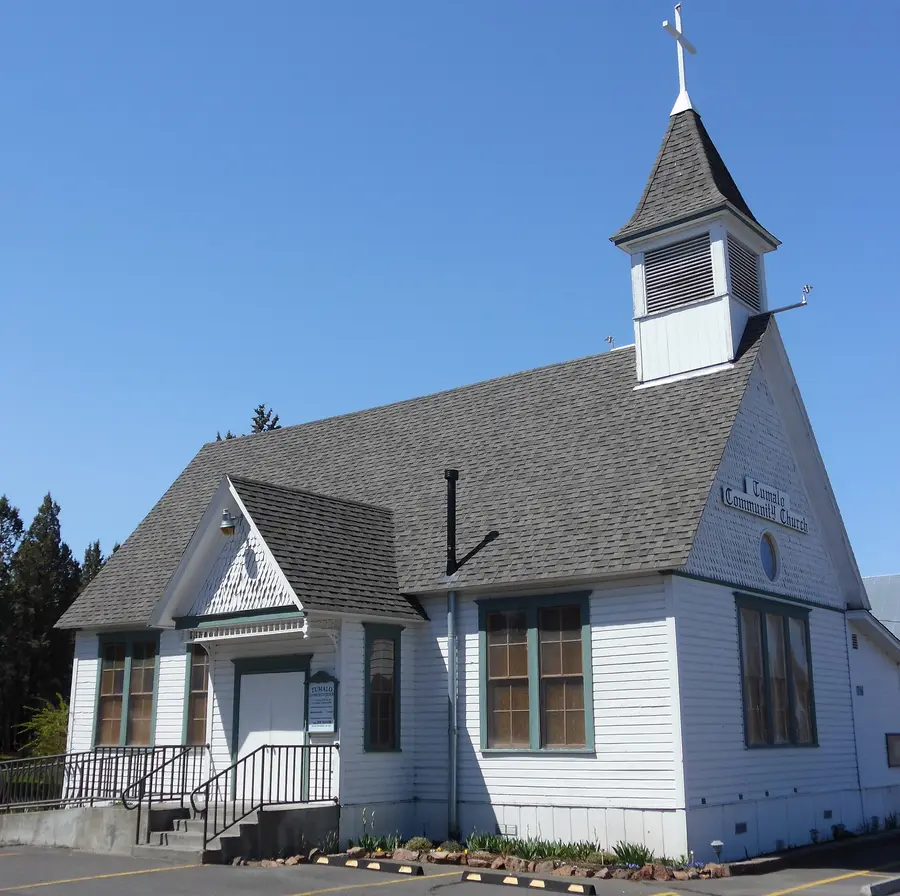
Tumalo is an unincorporated farm community northwest of Bend on Highway 20, with 558 residents in the 2020 census. Around it are irrigated pastures, horse properties and acreage homes fed by the Tumalo Irrigation District, plus Tumalo State Park on the Deschutes. Schools here are Redmond School District, not Bend-La Pine: Tumalo Community School, founded in 1906.
Housing, schools, parks, transit & food
Where it is
Unincorporated Deschutes County, northwest of Bend along Highway 20 and the Deschutes River.
Housing
Acreage homes, farms and ranchettes, with a small cluster of homes in the old town.
Schools
Redmond School District: Tumalo Community School.
Parks & trails
River, open pasture and a quick drive to Shevlin Park and the Cascades.
Tumalo State Park on the Deschutes
Getting around
No Bend bus service; the Bend-Sisters route 29 runs on Highway 20.
Dining & groceries
A handful of local businesses in the old town; groceries and most restaurants are in Bend or Redmond.
Who it suits
People who want land, animals or a shop, and a 12-minute drive to downtown.
Trade-offs
Different school district
Well, septic and irrigation-water rules
Rural roads and services
Short-term rentals: Deschutes County rules apply, not the City of Bend’s.
Visitors vs. Residents: Where to Stay vs. Where to Live
The best place to stay for a weekend is not automatically the best place to live for five years. Visitors usually want to walk to dinner, the river or a concert, or to be close to Mt. Bachelor. Residents care more about commute, schools, snow and ice on the driveway, grocery runs, wildfire prep and whether the evening walk actually goes somewhere.
Zillow Home Value Index for each official district, September 2026: the typical value of a mid-priced home (single-family and condo), with the change from a year earlier. Bend overall: $721K (−0.6%).
Sisters · Median single-family sale, Sept. 2026 (Beacon Report)$735K
Sunriver · Median single-family sale, Sept. 2026 (Beacon Report)$860K
La Pine · Median single-family sale, Sept. 2026 (Beacon Report)$350K
Bend’s market moves monthly. For a specific house, pull recent sales for that street, and see our guide to Bend real estate agents.
Bend schools by neighborhood
Bend-La Pine Schools uses attendance boundaries: students enroll at the neighborhood school assigned to the home address, then can apply to transfer or to a magnet or choice school. Attendance lines do not follow district lines, and a neighborhood name never guarantees a school.
Summit High
West of the Deschutes: River West, Summit West (NWX, Discovery West), Awbrey Butte, Century West, Tetherow and Broken Top.
Bend Senior High
The central core east of the river: downtown, Larkspur, the south part of the Orchard District and a band east toward the city edge.
Mountain View High
North and northeast: Boyd Acres, Mountain View and the north end of the Orchard District.
Caldera High
South Bend: Southwest Bend, Southeast Bend, most of the Old Farm District, and areas south of the city such as Deschutes River Woods.
The high-school areas above are a summary of Bend-La Pine Schools’ 2026 attendance map. Tumalo is in the Redmond School District. Magnet elementaries (Amity Creek, Highland, Westside Village) take students by application with preference zones.
Getting around: transit, bikes and drive times
Bus: Cascades East Transit runs ten fixed routes in Bend (1–9 and 11) on weekdays from about 6 a.m. to 7:45 p.m., and most routes run Saturdays. There is no Sunday fixed-route service in the current schedule. Every route meets at Hawthorne Station in the Orchard District. Since May 2026, routes 1 and 4 on Third Street run every 15 minutes in the weekday midday, with 15-minute segments near St. Charles, Neff Road and 27th Street. Commuter routes go to Redmond (24), Sisters (29) and La Pine (30), and seasonal buses run to Mt. Bachelor.
Best-served districts: the Orchard District (every route), Larkspur (5 routes), Mountain View and Old Farm (4 each). Awbrey Butte has no stops, and most of Summit West, Century West and Southeast Bend have one route each.
Bikes: central Bend is flat and compact; most of the 13 districts are within about 4 miles of downtown. The westside climbs, and the Parkway, Third Street and the river are the main barriers east to west.
No-traffic estimates from the middle of each district (or the named spot) using OpenStreetMap roads. Add time on powder mornings, summer weekends and at the Parkway at rush hour.
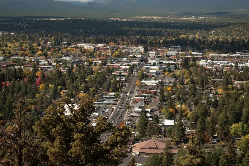
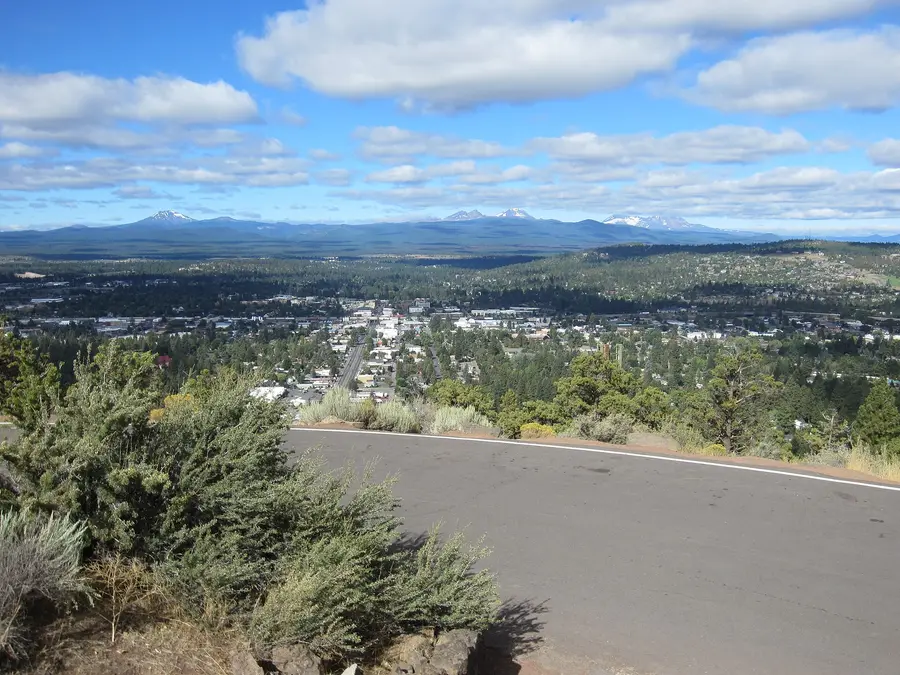
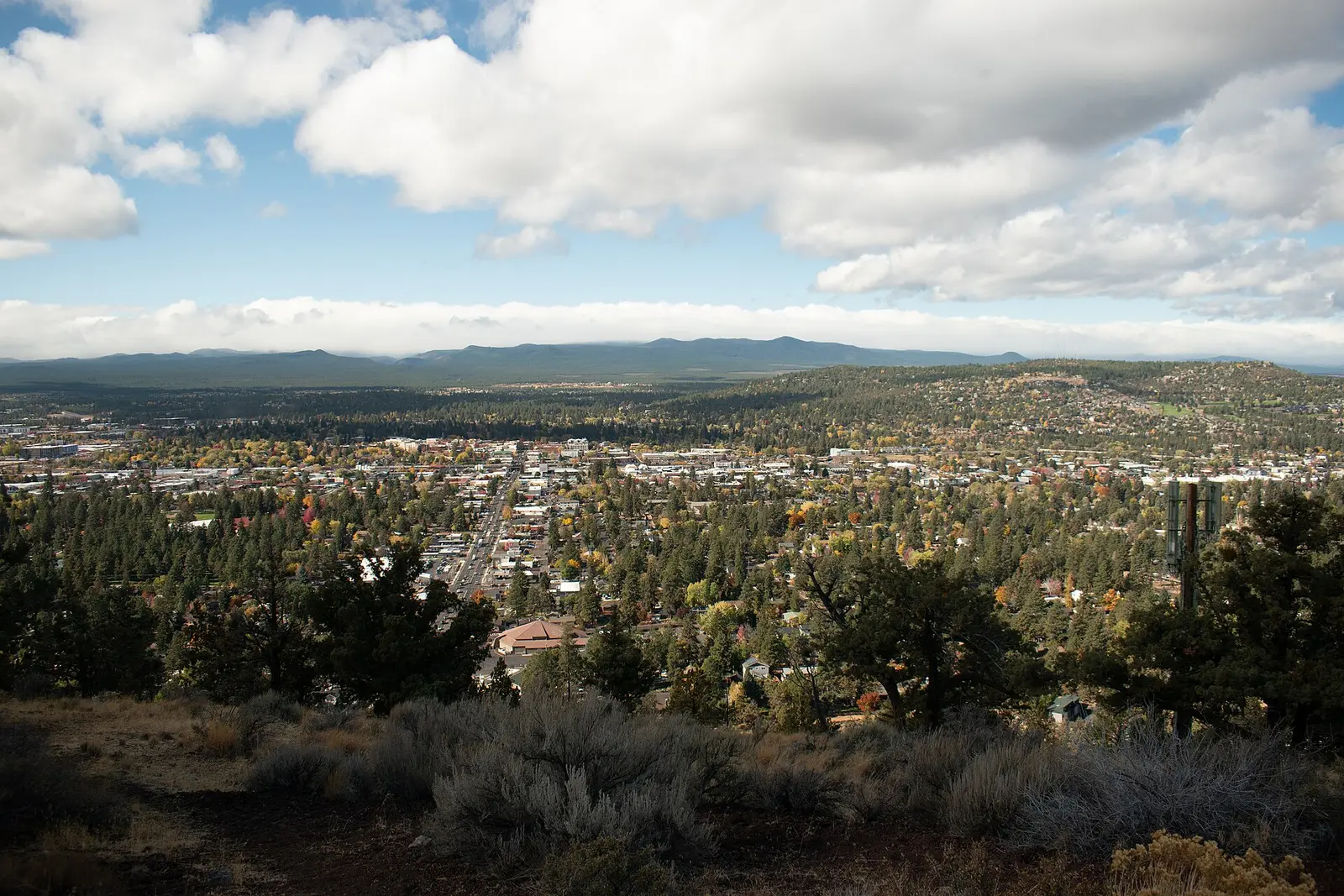
The whole city from Pilot Butte: eastside in the foreground, westside and the Cascades beyond. Roc0ast3r, CC0
Westside advantages
Closest to Mt. Bachelor, Phil’s Trail, Shevlin Park and the Cascade Lakes (38–42 minutes to West Village)
The most walkable restaurant clusters: Galveston, Newport, downtown’s north half and NWX
The river, the whitewater park and the Deschutes River Trail
Summit High and four public schools inside Summit West
Westside trade-offs
The highest home values: Awbrey Butte, Summit West and Century West all top $1 million
Ski and summer traffic on Century Drive and Galveston
Hills, snow and ice in the northwest
Forest-edge wildfire prep
Eastside advantages
Lower prices: Mountain View, Larkspur, Boyd Acres and Orchard are all under $600K typical
St. Charles Bend, the main shopping corridors and most bus routes
Newer homes on the south and east edges, bigger yards for the money
Urban trails: the Larkspur Trail, Pilot Butte, Pine Nursery and Alpenglow parks
Eastside trade-offs
45–51 minutes to Mt. Bachelor, and crossing the Parkway and river at rush hour
Fewer walkable restaurant clusters outside Midtown and Third Street
More car-oriented street layouts in newer subdivisions
Neither side is better in general. The right answer is the one that matches your weekly routine.
Short-term rental rules by neighborhood
If you are buying with an Airbnb or VRBO in mind, the neighborhood matters as much as the house. Inside city limits:
Type I
Owner-occupied (up to two bedrooms in the home you live in), infrequent whole-house rentals (up to 29 days a year in up to four rental periods), and whole-house rentals in commercial and mixed-use zones. No spacing rule.
Type II
Whole-house rentals over 30 days a year in residential and Mixed Use Riverfront zones, including ADUs. Since Nov. 18, 2022, no other approved whole-house rental can be within 500 feet. The City estimated that left 46% of residential properties eligible.
Everyone
An operating license from the City ($360 to start, $260 a year plus a transportation fee supplement on the City’s current page) and 10.4% room tax, except infrequent-use rentals. Permits issued after April 15, 2015 do not transfer when the house sells.
Exempt from the land-use permit: Mount Bachelor Village, Deschutes Landing and the Courtyards at Broken Top (units 1-8 and 21-32). Old Mill District riverfront properties are outside the 500-foot rule. Outside city limits (Deschutes River Woods, Three Rivers, Tumalo), Deschutes County rules apply. Check the City’s STR page before you buy.
Wildfire and winter by neighborhood
Wildfire: the highest-exposure areas are on the forested west and south edges: Awbrey Butte, Summit West and Discovery West, Century West, Tetherow and Broken Top, plus Deschutes River Woods and Three Rivers outside the city. The 1990 Awbrey Hall Fire burned more than 3,350 acres and 22 homes on Bend’s west side.
Oregon repealed its statewide wildfire hazard map in 2025 (SB 83), so there is no state map attached to a listing. Do your own check: ask about defensible space in the first five feet around the house, roof and vents, and whether the street belongs to one of Bend’s 40-plus Firewise USA communities. Bend Fire & Rescue’s Own Your Zone program covers the basics and free home assessments. Smoke days affect the whole city in late summer; see what to do on a smoky day.
Winter: Awbrey Butte and the westside hills are the hardest places to drive after snow, with steep streets and driveways. Flat east and south neighborhoods are easier, but everyone needs a plan for snow on the driveway. See getting a Bend home ready for winter.
What are the official neighborhoods in Bend, Oregon?
The City of Bend recognizes 13 Neighborhood Districts: Awbrey Butte, Boyd Acres, Century West, Larkspur, Mountain View, Old Bend, Old Farm District, Orchard District, River West, Southeast Bend, Southern Crossing, Southwest Bend and Summit West. They are set up under Bend Code Section 1.70 and funded with City tax dollars.
Is NorthWest Crossing an official Bend Neighborhood District?
No. NorthWest Crossing is a master-planned neighborhood inside the Summit West Neighborhood District, along with Discovery West and the neighborhoods on Shevlin Park Road.
Is Discovery West part of Bend?
Yes. Discovery West is a 245-acre neighborhood inside Bend city limits, in the Summit West district immediately west of NorthWest Crossing and north of Summit High School.
Is downtown Bend in Old Bend or River West?
Both. On the City’s district map, Wall and Bond streets around Oregon and Minnesota avenues (including the Tower Theatre) are in River West, while the blocks around Franklin and Arizona avenues and Drake Park are in Old Bend.
Which Bend neighborhood is most walkable?
Downtown, split between River West and Old Bend, is the most walkable part of Bend. River West has by far the most restaurants, cafes and bars of any district. NorthWest Crossing’s town center and the Old Mill District are the other walk-to-dinner areas. The exact block matters more than the district name.
Which neighborhoods are best for outdoor access?
Summit West (Shevlin Park, 981 acres) and Century West (Phil’s Trail and Century Drive) are best for westside trails and the Cascades. River West and Southern Crossing have the river, the whitewater park and the river trail. On the east side, Larkspur has the 3.9-mile Larkspur Trail and Pilot Butte.
Which neighborhoods are closest to Mt. Bachelor?
Century West, Tetherow and Broken Top are about 38 minutes from Mt. Bachelor’s West Village with no traffic. Southern Crossing, Old Bend and River West are 39-41 minutes. The east and north districts are 45-51 minutes. Ski-day traffic on Century Drive adds time.
Where are the historic homes?
Old Bend and the river blocks of River West, around Drake Park and Mirror Pond, have most of Bend’s early-1900s homes. Parts of the Orchard District and Midtown have older, smaller houses too, though infill is happening everywhere in central Bend.
What is the difference between a Neighborhood District and an HOA?
A Neighborhood District is a civic group recognized in City code that represents homeowners, renters and businesses and plays a role in land use. An HOA is funded by homeowner dues, covers a subdivision, and sets property rules and design guidelines. A home can be in both.
What is the best neighborhood for families?
It depends on what you need nearby. Summit West has four public schools inside it, Boyd Acres has three elementaries and a middle school, Larkspur has Bend High and the Larkspur Trail, and Southwest Bend has two elementaries and many playgrounds. Check the school assignment for the exact address in Deschutes County’s DIAL tool.
What is the most affordable Bend neighborhood?
By Zillow’s September 2026 home value index, Mountain View ($540K) has the lowest typical home value of Bend’s 13 districts, followed by Larkspur ($558K), Boyd Acres ($589K) and the Orchard District ($589K). The citywide figure was $721K.
What is the most expensive neighborhood in Bend?
Awbrey Butte has the highest typical home value of the 13 districts at about $1.15 million (Zillow, September 2026), followed by Summit West ($1.10M) and Century West ($1.05M).
Where should I stay in Bend as a visitor?
Downtown (River West and Old Bend) if you want to walk everywhere, the Old Mill District for concerts and the river, Century Drive for skiing and mountain biking, and north Third Street for lower prices and early flights out of Redmond.
Can I run a short-term rental in my Bend neighborhood?
Maybe. Inside city limits, a whole-house rental rented more than 30 days a year in a residential or Mixed Use Riverfront zone needs a Type II permit and must be at least 500 feet from another approved whole-house rental (Old Mill District riverfront properties excepted). Owner-occupied rentals of up to two bedrooms and rentals under 30 days a year are Type I. All rentals need an operating license, and most pay a 10.4% room tax.
Which school will my Bend address go to?
Bend-La Pine Schools assigns students by home address. Enter the address in Deschutes County’s DIAL tool (dial.deschutes.org) and open “Service Providers” to see the assigned elementary, middle and high school. Tumalo is in the Redmond School District.
Does Bend have public transit?
Yes. Cascades East Transit runs ten fixed routes in Bend on weekdays from about 6 a.m. to 7:45 p.m., with most routes also running Saturdays. All meet at Hawthorne Station in the Orchard District. Commuter routes connect to Redmond, Sisters and La Pine, and seasonal buses run to Mt. Bachelor.
Which Bend neighborhoods have the most wildfire risk?
Neighborhoods on the forested west and south edges: Awbrey Butte, Summit West, Discovery West, Century West, Tetherow and Broken Top, plus Deschutes River Woods and Three Rivers outside the city. Bend Fire & Rescue’s Own Your Zone program and Bend’s 40-plus Firewise USA communities focus on defensible space there.
Sources and photo credits
Checked October 23, 2026. Walk, bike and outdoor ratings are All Things Bend’s, built from mapped restaurants, groceries, parks, trails and bus stops in each district. “In the district” lists use OpenStreetMap locations inside the City’s boundary lines.